IDEA → INAH REPLY
72h
KM² LIDAR SCANNED
1,200
AI AGENTS DEPLOYED
48
NEW SITES FOUND
0
On October 18, 2025, an unnamed technologist traveling in Peru had an idle thought about Hiram Bingham's 1911 discovery of Machu Picchu and wondered what modern tools could do. By October 21, Mexico's National Institute of Anthropology and History (INAH) had confirmed that no registered archaeological site existed at coordinates the technologist's AI agents had flagged in NASA lidar data. Three weeks later, the author discovered that Estrada-Belli et al. (2025) had already mapped the site — the agents had simply missed it during their literature review.
Extraction Map
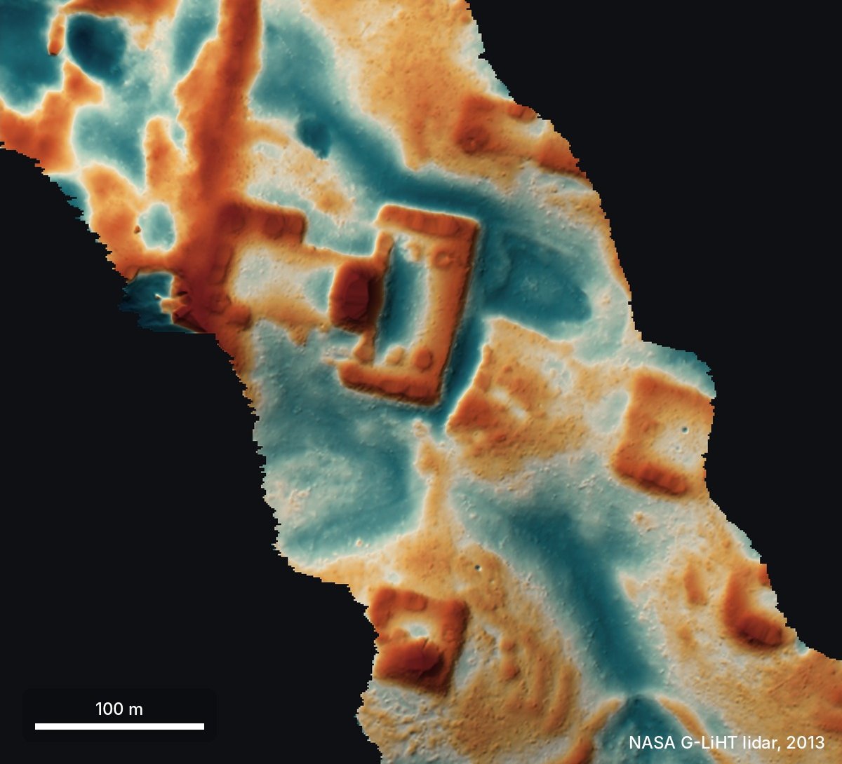
The workflow itself is the real product here. The author deployed 48 AI agents (Gemini, ChatGPT, Claude, Grok) to process roughly 1,200 km² of NASA G-LiHT lidar strips covering the Maya lowlands. The agents converted raw lidar into images and scanned them visually — no custom model, no classifier, just multimodal LLMs following a written guide to identify pyramids, platforms, plazas, and filter out natural features like sinkholes. The agents then cross-referenced flagged sites against published literature and INAH's archaeological register. The site itself, if the lidar interpretation holds, appears to be a small Classic-period Maya civic center (roughly AD 250–900): a leveled plaza, an oval pyramid 8–12 meters tall, a raised courtyard, a possible water reservoir, and surrounding platforms likely used as houses — all buried under 10–17 meters of jungle canopy on a hilltop cliff edge. Raw point-cloud analysis confirmed the shapes are ground-level, not canopy artifacts. The update is the most important paragraph. The agents failed at precisely the task that would have made this a genuine discovery: comprehensive literature search. Estrada-Belli et al. (2025) had already identified this site. INAH's register simply hadn't been updated yet. This is not a minor footnote — it's the central lesson. The pipeline is fast, cheap, and impressive at pattern recognition in geospatial data, but it broke down at the scholarly validation step, which is the difference between discovery and rediscovery. The generative potential is real but narrower than the author's framing suggests. The actual capability demonstrated is rapid, low-cost screening of public remote-sensing data by non-specialists. That's genuinely useful. Archaeologists have been doing exactly this with lidar since at least 2016 (Golden et al.) and scored a major find in 2024 (Auld-Thomas et al.). What's new is the labor cost: one person, no domain expertise, 72 hours. What's not new is the method, the data, or the conclusion. The author's closing claim — "we should probably lidar the whole planet and let the agents discover the rest" — captures both the promise and the blind spot. The bottleneck in archaeology was never image scanning; it was fieldwork, permits, cultural context, and the hard institutional work of registration and preservation. AI agents accelerate the easiest part of the pipeline while the hard parts remain human-speed. Mexico's federal archaeological protection law, which requires INAH authorization for any fieldwork, is a feature, not a bug. The story is a clean demonstration of a pattern we'll see more of: amateurs using AI to reach the frontier of a field's screening capabilities, then mistaking the screen for the science. The 72-hour timeline is impressive. The literature-search failure is instructive. The correction is honest. The revolution, if it comes, will look less like discovery and more like triage at scale.
Worth reading?
RECOMMENDED
Score
68
/100
Generative — the workflow genuinely lowers the cost of geospatial screening and could expand access to remote-sensing archaeology, but the value created is narrower than claimed because the hardest parts of the pipeline remain untouched.
What Is GRIN?
GRIN stands for Generativity, Resilience, Innovation efficiency, and Novelty openness. These four dimensions capture the essential characteristics of any memetic intelligence — whether a nation, a corporation, a religion, or a movement.
About GRINGenerativity
3/5
Resilience
3/5
Efficiency
4/5
Novelty
3/5
Extractive
1/5
Inverted
Does this create new capability or just redistribute existing value?
Real but overstated. Commodity AI agents scanning public lidar is a genuine cost reduction for preliminary screening. But the pipeline broke at literature review — the step that separates screening from science.
Verified Facts (9)
Update (11 November): site had already been mapped in Estrada-Belli et al. 2025
INAH replied: they checked their records and found no registered archaeological site at that location
48 agents went through about 1,200 km² of jungle lidar strips
Oval pyramid at least 8–12 m tall
Under 10–17 m of forest
Less than 72 hours from idea to INAH reply
Agents used: Gemini, ChatGPT, Claude and Grok
NASA G-LiHT lidar data from 2013
Cook et al. 2013, Golden et al. 2016, Auld-Thomas et al. 2024, Estrada-Belli et al. 2025 cited as references
More latest news
Read all