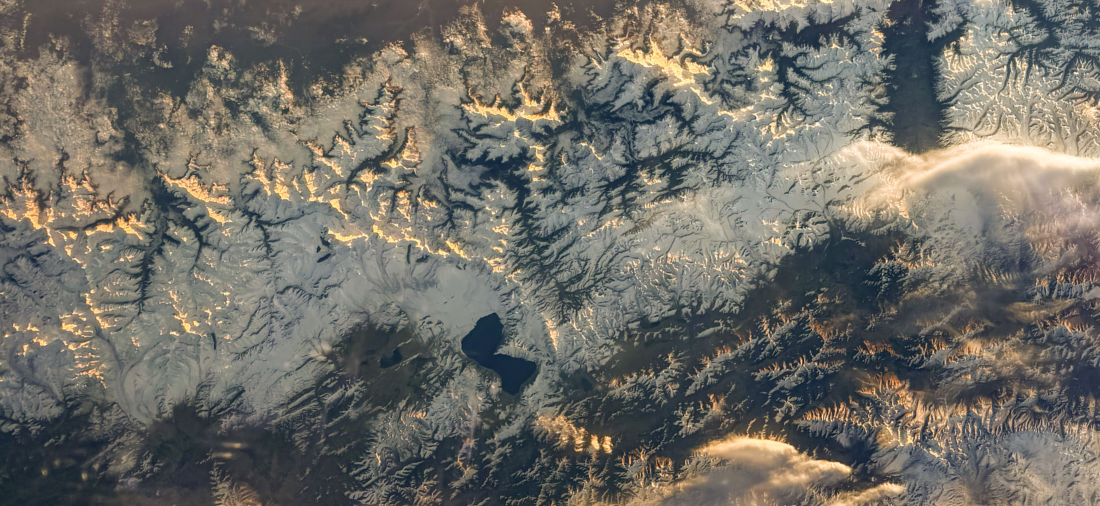
Canadian Space Agency astronaut Joshua Kutryk pointed a camera out of the International Space Station and captured Lake Pelku, a high-altitude lake on the Tibetan Plateau, as the station passed over Asia. That's the entire event. One photograph, one lake, one orbit. What makes the image worth pausing on is the platform, not the subject. The ISS has produced hundreds of thousands of crew-taken photographs of Earth since its first expeditions. These aren't tourist snapshots — they're a continuously updated visual archive of planetary surface conditions, taken from a vantage point roughly 400 kilometers up at orbital speed. Lake Pelku sits in one of the most geologically and climatologically sensitive regions on Earth. Tibetan Plateau lakes are bellwethers for glacial melt, monsoon variability, and tectonic activity. A single photograph won't tell you much. Thousands of photographs taken across years and seasons start to tell you a great deal. The ISS photography program occupies an odd niche: it's neither as systematic as dedicated Earth-observation satellites nor as incidental as it looks. Crew members shoot in real time, responding to lighting, weather, and opportunity. The result is a dataset that complements satellite imagery with oblique angles, variable focal lengths, and human judgment about what's worth capturing. NASA frames these images as supporting "research and disaster relief," which is accurate but undersells the cumulative value. The archive is a time-series of the planet's surface, freely available, taken from a platform that's been continuously crewed for over two decades. That's a resource whose full value won't be apparent for years. The photograph itself is what it is — a lake seen from space, credited to Kutryk via CSA. No drama, no breaking news. Just another frame added to a quietly extraordinary collection.
Worth reading?
OPTIONAL
Score
40
/100
Earth science enthusiasts, Tibetan Plateau researchers, and anyone who finds the ISS photography archive genuinely useful as a longitudinal dataset rather than a gallery.
Cultural Placement
Like Yann Arthus-Bertrand's 'Earth from Above' but stripped of editorial curation and artistic intent, with the mechanical regularity of a weather satellite but the compositional variability of a human hand. Sits in the tradition of NASA's 'Blue Marble' and the Earthrise photograph — images whose scientific value is inseparable from their aesthetic impact — but without the iconic ambition. Closer to a field notebook sketch than a gallery piece, and valuable precisely because of that modesty.
Honest assessment
This is a single photograph from a vast ongoing archive — scientifically useful in aggregate, unremarkable in isolation. Its value is as a data point, not as a standalone visual experience. Worth a glance if you care about the ISS observation program or Tibetan plateau geography; otherwise, move on.
What Is NOVEL?
40
/ 100
BedrockNews applies a structured analytical framework called NOVEL to cultural works — games, books, film, music, and more.
How NOVEL worksNerve
1/5
Originality
1/5
Voice
2/5
Endurance
3/5
Lineage
3/5
What did the artist risk? What could have failed?
Zero artistic risk. Standard ISS crew photography procedure — point camera at geological feature, shoot, caption, publish. The platform is extraordinary; the creative act is routine.
Verified Facts (5)
CSA/Joshua Kutryk is credited as the photographer
Photograph shows Lake Pelku near center of the image
ISS was orbiting above Asia when the photograph was taken
Station crew members have produced hundreds of thousands of images
Images record phenomena in real time and support research and disaster relief
More latest news
Read all