PEAK WINDS
220 km/h
SEA SURFACE TEMP
29°C
PROJECTED STORMS
11-15
REGIONAL SCALE
Cat 5
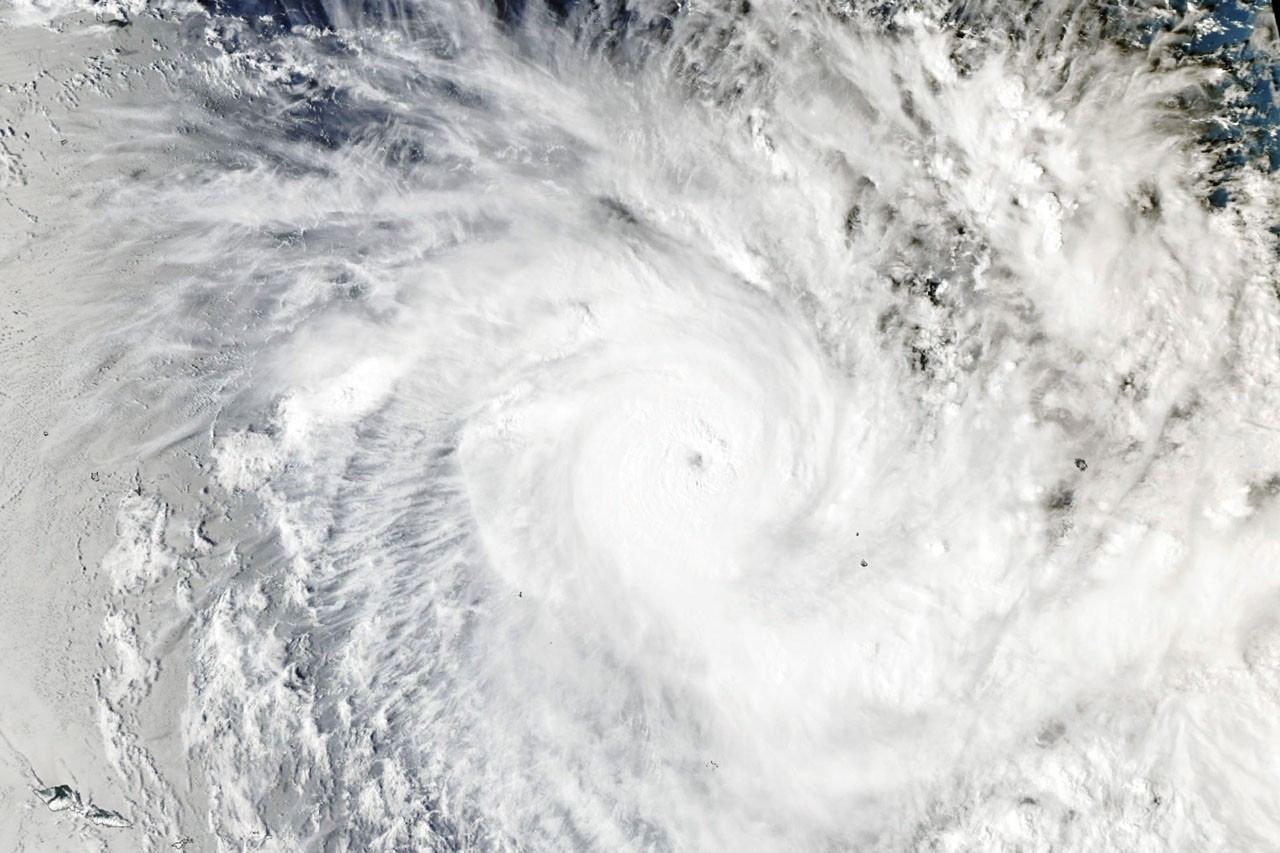
While the North Atlantic wrapped up an unusually quiet 2026 hurricane season, the Southwest Pacific delivered a sharp counterpoint. Tropical Cyclone Xavier rapidly intensified northeast of Samoa and the Cook Islands in mid-November, becoming the strongest November tropical cyclone east of the international date line in the historical record. The storm's peak winds hit 220 km/h (140 mph) — Category 5 on the regional scale, Category 4 Saffir-Simpson — fed by sea surface temperatures of 29°C and near-zero wind shear.
Extraction Map
Xavier's location and behavior are textbook El Niño signatures. NASA satellite data showed the storm developing along the southwestern edge of a massive warm-water tongue stretching from South America to the central Pacific, the thermal fingerprint of the El Niño present since June 2026. Research published by Oginni et al. (2025) in the International Journal of Climatology confirms that El Niño shifts Southwest Pacific cyclone activity northeast and fuels unusually rapid intensification — both patterns Xavier exhibited. The Fiji Meteorological Service began tracking Xavier as a slow-moving disturbance on November 15. By November 17, when the MODIS instrument on NASA's Aqua satellite captured the image at 02:53 UTC, forecasters estimated maximum sustained winds of 195 km/h (120 mph). Peak intensity arrived later that day. Colorado State University hurricane expert Phil Klotzbach flagged the record on social media, noting Xavier's exceptional strength for a November system in this part of the basin. Damage on the ground was real but contained. The northern Cook Islands took the worst hit, with reports of damaged homes, power disruptions, and food supply pressure on Manihiki. Xavier subsequently encountered dry air and unfavorable wind shear, weakening as it tracked westward and reducing the threat to Samoa and American Samoa. The broader context matters more than any single storm. The Fiji Meteorological Service's seasonal outlook projects 11 to 15 named tropical cyclones in the Southwest Pacific this season, with peak activity expected in February and the greatest risk concentrated east of the date line. Xavier is likely a preview, not an outlier. El Niño's influence on tropical cyclone geography is well-documented but still underappreciated in public risk planning. When the warm pool shifts east, so do cyclone formation zones — exposing island nations that may not experience direct hits in neutral or La Niña years. The Cook Islands, normally on the periphery of cyclone risk, found themselves in the crosshairs precisely because of this shift. The asymmetry between the quiet North Atlantic and the stormy Southwest Pacific underscores a persistent blind spot in global weather coverage. What happens in the tropics south of the equator receives a fraction of the media attention, even when record-breaking storms are threatening small island states with limited resilience and infrastructure.
Worth reading?
OPTIONAL
Score
44
/100
Neither generative nor extractive in the traditional policy sense — this is a natural hazard story. But the distribution of costs is extractive in structure: atmospheric energy generated by global emissions concentrates damage on small island nations with minimal resilience or fiscal capacity.
What Is GRIN?
GRIN stands for Generativity, Resilience, Innovation efficiency, and Novelty openness. These four dimensions capture the essential characteristics of any memetic intelligence — whether a nation, a corporation, a religion, or a movement.
About GRINGenerativity
2/5
Resilience
1/5
Efficiency
3/5
Novelty
2/5
Extractive
2/5
Inverted
Does this create new capability or just redistribute existing value?
NASA's MODIS observations and CSU's real-time tracking generate public knowledge, but no new adaptive capability or infrastructure is created. Pure observation, no capacity-building.
Verified Facts (11)
Fiji Meteorological Service began issuing updates about a tropical disturbance northeast of Samoa and the Cook Islands on November 15, 2026
Sea surface temperatures of 29 degrees Celsius (84 degrees Fahrenheit)
Xavier reached peak intensity of 220 kilometers (140 miles) per hour — Category 5 on the regional scale, Category 4 Saffir-Simpson
MODIS on NASA's Aqua satellite captured image at 02:53 Universal Time on November 17, 2026
Strongest November tropical cyclone east of the international date line on record, per Phil Klotzbach of Colorado State University
El Niño present in the region since June
Xavier was the basin's second named storm, following Wati in October
Fiji Meteorological Service projects 11 to 15 named tropical cyclones this season
Storm activity in the Southwest Pacific basin typically peaks in February
Xavier damaged homes and caused power disruptions in the northern Cook Islands
Oginni et al. (2025) published in International Journal of Climatology on ENSO influence on tropical cyclone genesis in the Southwest Pacific
More latest news
Read all